Sion Fort, Mumbai
Digital Twin
The Sion Fort in Mumbai, a listed ASI site, has been meticulously mapped and transformed into a 3D model using drone photogrammetry, providing comprehensive documentation of this historic landmark. Built in the late 17th century by the British East India Company, the fort served as a strategic lookout point and remains a significant reminder of Mumbai's colonial past.
In collaboration with the Archaeological Survey of India (ASI) and the Rizvi School of Architecture, this project aimed to preserve the fort's details for future study.
High-resolution aerial photographs were captured via drone flights, with Ground Control Points (GCPs) ensuring accuracy. These images were processed to create an orthophoto, Digital Surface Model (DSM), and Digital Terrain Model (DTM), revealing the fort's topography and structure. A dense point cloud generated a 3D textured mesh for detailed analysis, and 360-degree aerial shots provided a comprehensive view of the site.
This detailed documentation supports researchers and historians, enhancing the accuracy of geographical information systems (GIS) and contributing significantly to the preservation and study of Sion Fort.
YEAR
2023
LOCATION
Mumbai, MH, India
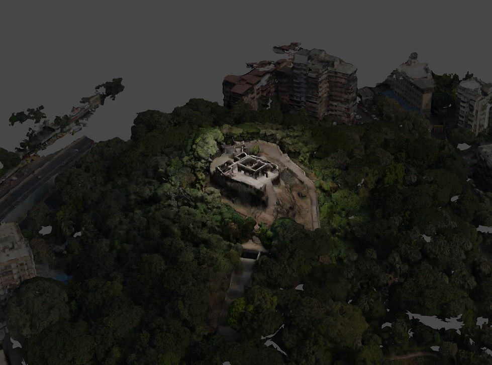
Night render of Sion Fort & its surroundings

Blue rectangles in the image show positions of the drone when images were captured.
More than 1200 images were captured and processed to generate a detailed 3D model of the fort and its surroundings.
The dense point cloud shows the volumes generated from the drone shots. In addition to documenting the Fort in great detail, the photogrammetry process also captured a large extent of the surrounding site including buildings, railway tracks and informal settlements.

Point Cloud generated from the photogrammetry process

3D model of Sion Fort
The generated model is highly detailed. Notice the textures of the rocks and ground in addition to the structure itself